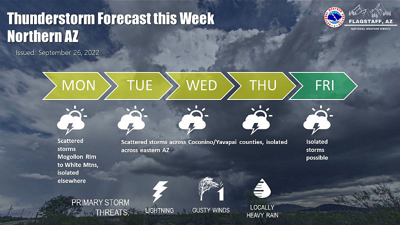
Slight chance for showers or thunderstorms this week.
Big Idea
- Clouds, slight chance of showers this week
- Breezy at times
- Nice weekend
- Read more...
We could get a few more storms this week.
Forecast Summary:
Monday: Partly cloudy. High in the lower 80s. Breezy at times.
Tuesday – Saturday: Partly cloudy, with a slight chance for showers or thunderstorms each day. Storms that form will drift towards the north or northwest at about 5 mph Tuesday – Thursday, then toward the east or southeast on Friday – Saturday. Breezy at times, especially near showers. Highs in the lower 80s. Morning lows in the upper 50s.
Sunday: Mostly sunny and becoming drier. Highs near 80. Lows in the low 50s. Westerly breezes 10-20 mph.
Forecast Table:
https://www.wrh.noaa.gov/forecast/wxtables/
Navigate on the map to your location and click for a detailed local forecast.
Forecast Discussion:
As high pressure rebuilds over the Four-Corners region, southeasterly wind will usher marginal amounts of monsoon moisture back into Arizona. Then, an upper-level trough will swing across the Great Basin and usher northwesterly wind across the state on Friday – Saturday, with possibly a weak cold front moving through. Therefore, we will see a slight chance of thunderstorms each day from Tuesday – Saturday. Thunderstorm drift will generally be toward the northwest or north today through Thursday, then shifting towards the east or southeast Friday – Saturday.
By Sunday, we will see the atmosphere drying out, and by next week the weather will feel a bit more like autumn. Fall is a great time of year to enjoy the outdoors here in northern Arizona, so get out and enjoy it! What is the outlook for the Southwest for the coming fall and winter? See the links below. Due to the fact that La Niña conditions (colder-than-normal sea surface temperatures between the dateline and the west coast of Central and South America) are expected to persist through the fall and gradually weaken early next year, dryer and warmer-than-normal conditions are more likely than not. This is not good news for southern California and southern Arizona, which depend heavily on the Colorado river watershed for their water supply. This is also bad news for northern and central Arizona, as our ground water supply and ability to survive the spring fire season depends mainly on winter rain (and especially snow pack).
https://www.cpc.ncep.noaa.gov/products/predictions/long_range/seasonal.php?lead=1
https://www.cpc.ncep.noaa.gov/products/predictions/long_range/seasonal.php?lead=4
Hurricane Ian has now formed over the Caribbean Sea and is moving northward towards the western side of Cuba. By the time it passes Cuba and moves over the Gulf of Mexico, it is expected to amplify into a major hurricane (with maximum sustained winds over 110 mph). Ian will likely make landfall on the West Coast of Florida between Wednesday and Friday. Though damaging winds are less likely on the east coast of Florida, here’s hoping that our Daytona Beach campus is not severely impacted by heavy rains/flooding.
Have a nice week!
C. James
--
Curtis N. James, Ph.D.
Professor of Meteorology
Applied Aviation Sciences
Prescott Campus
3700 Willow Creek Road
Prescott, AZ 86301-3720
928.777.6655
This email address is being protected from spambots. You need JavaScript enabled to view it.
Embry-Riddle Aeronautical University
Florida | Arizona | Worldwide
MetMail is an unofficial weather discussion and forecast transmitted once per week via email. Embry-Riddle offers an undergraduate bachelor-of-science degree program in Meteorology (https://erau.edu/degrees/bachelor/meteorology?campus=Prescott). Please spread the word to all potential qualified candidates!
Embry-Riddle Prescott Meteorology Website:
http://meteo.pr.erau.edu/
This has a selection of model forecast products and other links.
Official National Weather Service Forecast:
https://www.weather.gov/wrh/WxTable
This clickable map will give you an official detailed local weather forecast for any location in the Western U.S.


