Big Idea
- It’s going to be warmer than usual this week
- Precipitation is unlikely
- Extreme fire danger Friday – Sunday
Warm, breezy extreme fire danger
Forecast Summary:
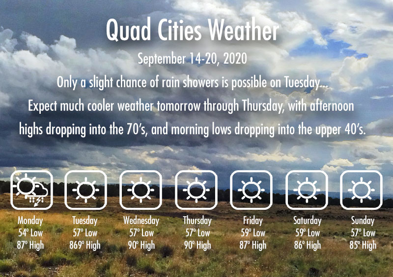
Mostly sunny with some breeziness in the afternoons this week. Some afternoon cloud buildups today with some isolated thundershowers in the mountains around northern AZ, but precipitation is unlikely. High clouds and stronger breezes with extreme fire dangers on Friday – Saturday. We will also have more periods with smoke spreading across the area from wildfires all across the Western US. Highs in the upper 80s to lower 90s. Lows in the upper 50s to lower 60s.
Forecast Table:
https://www.wrh.noaa.gov/forecast/wxtables/
Navigate on the map to your location and click for a detailed local forecast.
Discussion:
A ridge of high pressure in the upper atmosphere will continue to dominate the weather pattern over the Southwest this week, with warm and dry conditions being the story yet again. A trough is expected to move into the Pacific Northwest and across the Great Basin on Friday-Saturday, flattening the ridge and bringing some stronger breezes and high clouds to our area. The stronger winds, combined with dry shrubs and grasses, will make for some critical fire weather conditions this coming weekend. Be careful to continue adhering to local fire bans!
Some would ask whether monsoon moisture will be returning to Prescott this year, and some would justifiably argue that it never really arrived. It appears unlikely, based on the current extended forecast for the rest of the month, that we will receive more precipitation this month. According to http://water.weather.gov/precip/, the quad City area had anywhere from 1-4 inches of rain during the past 90 days, which is between 2-8 inches below normal (depending on your location). This was one of the driest and hottest summers on record for Prescott! Thank goodness it happened after a fairly wet winter from 2019-2020.

The outlook for the coming winter is not good for precipitation, as La Niña conditions are present and are expected to continue through the coming winter. These conditions, characterized by cooler-than-normal sea-surface temperatures in the Eastern Tropical Pacific, generally (but not always) favor drier and warmer-than-normal conditions for the Southern U.S. (but wetter-than-normal in the Northern U.S.).
Curtis James
--
Curtis N. James, Ph.D.
Professor of Meteorology
Department of Applied Aviation Sciences


Met Mail is an unofficial weather discussion and forecast transmitted once or twice a week via e-mail by the Embry-Riddle Department of Meteorology (http://meteo.pr.erau.edu/). Embry-Riddle offers an undergraduate bachelor-of-science degree program in Applied Meteorology. Please spread the word to all potential qualified candidates!
Further Information:
ERAU Applied Meteorology degree program
Official National Weather Service forecast
Embry-Riddle Aeronautical University: Website | Facebook | Twitter | YouTube


